Tuesday, July 25, 2006

Horse Fire IX

Just when you think it’s safe to get a good night of unworried sleep, this darned fire jumps up and slaps you upside the head. A couple of hours ago, everything I could find out sounded like this fire was on its way down.

Now I’m not so sure.

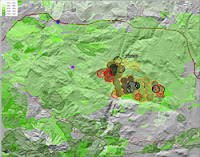
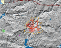
The top map is zoomed out to show the entire fire, with satellite data that’s current as of 6 PM. The green splotch is where our home is. The purple splotch south of the west flank of the fire is a lookout point that we drove to at about 5 PM. To the north and slightly east of that vantage point, I’ve shaded in blue the places where we saw some open flames — not a huge blaze, mind you; more like a collection of bonfires a few hundred feet apart.

The MODIS data (see earlier posts for an explanation of how this data is gathered) shows active spots to the west of Lyons Valley Road for the first time. This is worrisome for us, as it indicates the fire is still burning its way toward us. As we expected, there is activity on MODIS all around the north half of Barrett Lake, and out toward Lake Morena.

The center map, directly at right, shows the same data but zoomed in to show just where our home is and that worrisome western flank of the fire. Again, the green splotch is where our home is, and the blue shaded area is where we saw flames at 5 PM. Those two red MODIS splotches closest to our home is what will keep me from sleeping well tonight…

I called the CDF info line again, and learned that they’re still estimating the burned area at 15,400 acres and just 5% contained. My own estimate, from the satellite data, is that 33 to 39 square miles (22,000 to 25,000 acres) have burned. CDF is reporting lots of assets on the fire: 1,164 people, 17 fire crews, 176 engines, 6 air tankers, 6 helicopters, 6 bulldozers, and 13 water tenders. They also say that the hot, dry weather and rugged terrain are hampering their efforts — of this I have no doubt. But it would be ever so much worse if we had bad winds, and thank goodness we do not.

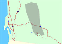
The bottom map is one I have not posted about before. This is the raw WF-HMS data from NOAA. On this map, our home is the blue dot. Their mapping system is not as sophisticated as the one I’ve been showing you maps from, as you can see from cartoonish presentation. One thing that’s particularly confusing is that they use a different map projection system, which has the result that their map appears to be sort of twisted in a clockwise direction by about 20 degrees from the maps you’ve been seeing. Nevertheless, it shows more current WF-HMS data, and it has something in addition: it shows the smoke pattern observed by satellite. And in the case of the Horse Fire, you can easily see that the high-level smoke is moving off mostly to the north.

This will likely be my last post for the evening, unless something dramatic happens. The temperature is cooling off rapidly (75F right now) and the humidity is rising just as quickly (36% right now) — both very good things for the firefighters.

And we are certainly wishing those firefighters well tonight…

Horse Fire IX

The Aqua (EOS PM) satellite, one of those carrying the MODIS imaging equipment, made a pass overhead just before 3 PM. Its view of our area was fairly oblique, as it passed way to the west of us…so the western flanks of the fire may have been invisible to it, as well as anything burning deep in Secret Canyon. It does show a broad area that’s very hot, near the western side of Lake Morena — the furthest part of the Horse Fire from our home…

The darned CDF information line is a bit like playing the slots. Most of the time you just get an old recording. If you’re lucky, you get a human, but they don’t really know very much. If you hit the jackpot — and I just did — you get a human who is well-informed. And even had a sense of humor!

From my jackpot CDF lady I got a good verbal report of the areas still burning (I’ve hand-shaded these purple on the map). The one of most concern to us is the western flank of the fire, and she described an area that jibes nicely with what the survey crew told us. It’s still not an immediate concern for us. She also told us where it’s burning in Secret Canyon; that’s the northernmost purple splotch. It’s also burning on the north and east sides of Lake Barrett — but the honor camp (for dishonorable people) is still safe. And finally, the major burn area is in Bobcat Meadows, just west of the northernmost part of Lake Morena — this jibes nicely with the MODIS data.

The eastern flank of the fire — out near Lake Morena — is still in a wilderness area, but getting closer to civilized areas. I hope they can stop it before it passes Lake Morena, headed east…

Horse Fire VIII

Around 12:30 PM this afternoon we saw a quickly growing column of white smoke suddenly pop up from behind Gaskill Peak (as seen from our yard). The CDF information number was back on a recorder (with a four hour old message), and there’s been no new satellite info since 7AM. We were worried, so we decided to do another reconnoiter.

On Sunday evening, the last time we did a reconnoiter, we made it to a roadblock at the red line on the map at right. From there, we had a great view of the valley that Barrett Lake is in, and north to Horsethief and Secret Canyons, where the fire was burning. This afternoon we only made it to the purple line, where a new roadblock was installed. My theory is that the CDF is using Lyons Valley Road for helicopter operations; my evidence is that we saw four fuel trucks leaving.

Our home is in the green splotch. The blue line is roughly the ridgeline that lies between us and the fire. We’re very fond of the ridgeline — not only is it a beautiful view from our home, but it’s also a very defensible line for the fire-fighters, should the fire start burning west of Lyons Valley Road.

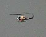
On the way down Skyline Truck Trail, and on the part of Lyons Valley Road that we could drive, we saw helicopters very low overhead, and fuel trucks parked at several locations — probably staged for quick use when needed.

Right at the roadblock, we saw a CDF survey team pickup parked, with one crewmember trying to open the locked gate. I took advantage of the moment to talk with the driver, who was very informative. From her we learned:

— The Carveacre voluntary evacuations were ordered because the community is so difficult to evacuate, with just one twisty, steep dirt road for access. It’s not that Carveacre is immediately threatened.

— The fire is still entirely east of Lyons Valley Road. She gave us a good verbal description of where it’s burning on the western flank of the fire; I’ve shaded that area in yellow on the map.

— She confirmed that the CDF was making a stand on Lyons Valley Road, and had the objective of keeping the fire on the eastern side of it.

— She told us that all the ridgetops (being defensible and accessible to the planes) were being “painted” with fire retardant.

Then her crewmate got the gate open, and they took off to do some reconnoitering of their own. As we walked back to our car, we saw the most amazingly stupid thing I’ve seen in quite a while. A pair of cars was stopped in the middle of the road, with the two drivers talking to each other through their open windows. The road was narrow in this area, so they completely blocked it. Behind them was a line of 7 firefighting vehicles, trying to get out of the Skye Valley area (near Lake Barrett), including fuel trucks, crew operations trucks, and a helicopter logistics truck. These two idiots sat there with all this equipment held up behind them, just jabbering away. When I hollered over at them that they were gumming up the works, one of the drivers answered back with a rude comment about my ancestry. But they moved, finally.

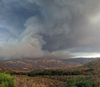
Just before we pulled out to head back home, I took a good look at the visible smoke plumes. The biggest one, by far, seemed to be coming from further east, out toward Lake Morena. The closer in burn area, on the western flank and most concerning to us, showed much less smoke. We took some comfort from that…

Horse Fire VII

Several of my readers have emailed to ask me how on earth I could possibly see anything good coming out of the Horse Fire. One of them (who shall remain unnamed) even accused me of being around-the-bend insane. This is an attempt to defend my sanity.

These maps show a larger area than the recent maps I’ve published. In both of these, there’s a purple square in the area where our home is, just to the left of center.

The upper map has pinkish areas that show all the areas burned in fires that occurred from 2000 through 2005. Those pink areas are the least likely to burn again within the next few years, because much of the fuel is gone. I’ve driven through those pink areas to the northwest of our home within the past few weeks — and even though that fire was in 2001, five years ago, there’s still very little fuel there.

But if you start with that purple square, and look at the 90 degree swath of land from about NE to about SE, you’ll see that there’s virtually nothing that’s burned within the past six years — for miles and miles and miles. During a Santa Ana wind condition, that’s the direction the winds are coming from — so any fire that started out in that direction during a Santa Ana would pose a big risk to us.

Now if you look at what the Horse Fire has done, you’ll see that it has reduced the aperture of risk considerably. Any fire starting to the east of the Horse Fire’s area will have to go around that burned area to get us. It’s still not impossible for it to do so, of course — but it’s definitely going to slow such a fire down, and remove a whole bunch of fuel that could have made it grow.

The lower map (at right) shows different green shadings for fires in the decades between 1950 and 1999. Most of that map is covered by an area burned in 1972. All of Lawson Valley, including where our house now stands, was burned that year. We’re living amidst 34 years of fuel accumulation — and that’s the same kind of accumulation that the Horse Fire is now burning in.

The most relevant thing visible on this map is due south of the Horse Fire, where there’s an area of about the same size as the fire that isn’t burned on either of these two maps. That means that there’s over 50 years of fuel accumulated in that area — making it the biggest risk area left anywhere near our home. Between that area and our home, very little has burned since 1972. If any fires pop up in that area, you can bet we’re going to be watching closely and biting our fingernails…

Horse Fire VI

Just got off the phone with a real person at CDF, instead of the recording they’ve been using. This person, who seemed to actually have some sense of what was really going on, gave me several pieces of useful information:

— Winds on the scene are light, erratic, and not a problem.

— The fire has not (yet) crossed west of Lyons Valley Road. This is the last road between the fire and Lawson Valley, where we live.

— Primary fire activity currently is near Lake Morena and on the east side of Barrett Lake.

— Wind forecast is for moderate winds to the northeast. This is good for us, bad for Guatay/Pine Valley.

Horse Fire V

Acrid smoke in the air this morning — smells very strongly, with an acidic bite. It’s reminiscent of the Cedar Fire three years ago; not a pleasant memory.

The map at right was current as of 6 AM this morning. I’ve had some questions about the satellite data and exactly what it’s showing. Here’s what I understand after some research last night and this morning.

The MODIS data shows up as one kilometer (about 0.6 miles) diameter circles with slanted line shading in them. Where there’s a circle, the satellite detected heat. The heat measurement is integrated over the entire one kilometer circular area — so a pinpoint of extremely intense heat could trigger it, and so could a broad area of much lesser heat. It does not necessarily mean fire — but it probably indicates at least some fire somewhere in that circle. The colors of the splotches indicate their age. Red splotches are less than 12 hours old; orange splotches are 12 to 24 hours old, and black splotches are more than 24 hours old.

The WF-HMS data is much different. This is data generated by the NOAA as a result of a human analyst who is looking at several different sources of data. The data available to the analyst includes MODIS, visible light imagery, smoke plume detection, and more. The analyst then makes an estimation of where actual fires are, placing dots on a 250 meter grid to indicate them. They’re visible on this map as relatively small solid red dots. The red dots are less than 24 hours old; if there were any data 24 to 48 hours old, they’d show up as yellow dots.

I’ve hand-drawn a few features on the map:

The green splotch at left is the area where our home is.

The purple arrow points to a purple dot; that’s where we stood on Sunday evening when we reconnoitered the fire. Just above and to the right of that purple dot, you can see one of the small red WF-HMS dots (just to the right of the black line that indicates Lyons Valley Road).

The blue horseshoe shaped line (open to the left) is the approximate ridge line of the line of mountains that forms Lawson Valley (where we live). The fire is on the other side of that ridge from us. This matters because ridgelines form naturally defensible lines for the firefighters — fire moves much more easily up a slope than it does down a slope, and the ridge makes and easy target for the aerial tankers. Having a very defensible line between us and the fire is a very good thing that we are taking some comfort from.

The large yellow shaded area at top and toward the left (west) is the community of Carveacre. There has been a voluntary evacuation of Carveacre for most of the past 48 hours, and we’re still trying to figure out why. The fact that the CDF has the evacuation in place is worrisome, as the community of Carveacre is (as you can see) quite close to us.

I just listened to the latest CDF report, and its a real eye-opener. First thing: they’re now reporting 15,500 acres consumed, which is very close to the estimate I made yesterday from the satellite data. There’s a lesson there: the CDF reports are not current. CDF is now reporting a lot more assets on the fire: 770 firefighters, 102 fire trucks, 8 bulldozers, 7 helicopters, and 6 aerial tanker planes. They’re still reporting just 5% containment, which probably mainly reflects the fact that the fire is mostly burning in remote wilderness areas.

The CDF also reports that with the evening, the actively burning areas are much diminished — but with the heat of the day, they expect strong flareups in three areas: Secret Canyon (the part burning to the northeast toward Pine Valley and Guatay), Hauser Canyon (the part burning to the east, and nearing the western edge of Lake Morena), and (most worrisome to us) the part burning on all sides of the northern half of Lake Barett. The latter part is four to five miles away from our home; it’s the area I took pictures of on Sunday.

As I prepared this post (and after I prepared the map at right), there was another satellite update. The MODIS data is largely unchanged.

Monday, July 24, 2006

Horse Fire IV

Verbal report from the CDF, at 12:10PM: the hotspot that is leftmost on the map in the previous post has flared up, and is burning rapidly to the northeast, up Secret Canyon toward Pine Valley and Guatay. There are voluntary evacuations of Guatay and Pine Valley underway, along with Carveacre.

There’s a lot more smoke in the air, quite suddenly.

This is not good news, but it doesn’t look like any increased threat to our home. But the fact that Carveacre keeps popping up is really bothersome — it’s the closest community to us (line of sight), and according to all the information I have, the fire is burning away from it. So why is it being evacuated?

Horse Fire III

This is the latest MODIS satellite imagery (around 11 AM). The intensities are lower, and now there are just three smallish areas with active fires. All good news.

I just called the CDF information line, and instead of a recording I got a live person. Unfortunately, this live person seemed to have no idea what he was talking about; I got no useful information from him at all, except that he said the CDF’s estimate of the size was now 7,000 acres.

So I guess its down to who am I to believe: the CDF information line, or the satellite’s lyin' eyes.

I’ll take the satellite…

Horse Fire II

Given what we saw on yesterday’s reconnoiter of the fire, we were not terribly concerned about risk to our home, but still we didn’t think it was prudent to just go to sleep — after all, this rather large wildfire was burning just over the hill from us! But around midnight, it became clear that we simply weren’t going to get any more news — every source of information shut down for the night. The MODIS satellite only makes a few passes a day over any given spot, so we’d be waiting six or eight hours between updates on it. We assessed the risk as so low that making the long road trip out to the fire wasn’t worth it (the fire was only two or three miles in a straight line from our home, but to get there on roads is about 15 miles) — so finally we just gave up, and went to bed.

As of 7 am this morning, the CDF has not posted any news for today (their message is unchanged from last night). But…the MODIS satellite data (publicly available, in near realtime) shows a huge change from last night when I finally went to sleep. The map is at right, this time shown overlayed on a US Geodetic Service topo map instead of the simple shading as I used previously. As before, the green splotch on the left is where our home is. Now, however, we’ve got all kinds of MODIS data.

The orange slant-shaded areas (two splotches) are the 24-hour old data from yesterday. The red slant-shaded areas are between 4 and 24 hours old. The red solid-shaded areas are current as of about 6:45 am this morning; they show where the fire is burning right now. The blue arrow is my hand-drawn inferred path of the main fire.

Last night the CDF message was reporting 6,000 acres burned. My very rough estimate (from the MODIS data) is that 12,000 to 15,000 acres have burned as of this morning.

For us, the most immediately concerning thing is those two solid red splotches near where the fire started. Those are in the same area that I photographed last night; likely that means there has been no firefighting activity there (and we saw none last night). If those areas started burning toward the west, we could have problems. Obviously we will be keeping an eye on that. The center-of-mass of the fire, however, is about six miles due east of the observation point where we reconnoitered last night. The fire moved a long, long way in the still evening air (my weather station recorded no wind at all last night). To some extent, I’m sure that’s due to a combination of the rugged terrain (channeling air flow) and the heavy fuel loads. The area that’s burning is very difficult to get access to — my maps don’t even show any trails, let alone roads. The easternmost front has almost reached Lake Morena (a large man-made reservoir); if it makes it past the lake, every direction is populated. And south of the entire path of the fire is also populated; the beautiful Deerhorn Valley area. If it headed north from where it is currently burning, there are several more miles of wilderness and one of the last remaining large family ranches in San Diego County, then more populated areas (and also the areas burned three years ago in the Cedar Fire).

All in all, it appears that the risk to our home is still quite low. If I lived in Deerhorn Valley or Campo, I’d be considerably less sanguine right now. And as I have said earlier, the fuel consumed by this fire is substantially lowering our risk of the particularly deadly Santa Ana-driven wildfire, because all that fuel would be upwind of us in a Santa Ana…

Update 8 AM:

The CDF is now reporting 6,600 acres burned and 5% contained. They’re also reporting exactly the expected areas as “of concern", a lesser risk than “threatened”. I can’t make sense of the 6,600 acres given the clearly larger area burned on the MODIS data — either there’s something I don’t understand about the MODIS data, or the ground reports haven’t caught up with it…

Sunday, July 23, 2006

Horse Fire

The fire that I posted about earlier today now has an official name: the “Horse Fire” (so called, I presume, because it started in the upper reaches of Horsethief Canyon). According to the last information for this evening, it has now consumed over 6,000 acres and is completely uncontained. During the day there were 4 tanker planes, 4 helicopters, 50 engines, 4 water tenders, 4 bulldozers, and 500 firemen fighting the fire. Now that its after dark, the aircraft have stood down — but the fire crews and all that equipment will be at it all night, in the relative cool and still air. We wish them all well.

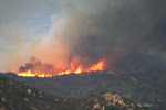
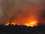
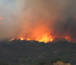
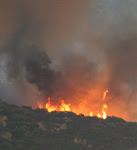
This evening, just before dark, Debbie and I, along with Jim (our friend and neighbor), set off on a reconnoiter. This was prompted by the rapid growth of the smoke plume combined an ambiguous CDF message telling us that the fire was burning away from us — but that a community between us and the fire (Carveacre) was “threatened”. This made no sense to us, so we decided to see if we could eyeball it ourselves. The lack of up-to-date and accurate information in these situations is extremely frustrating. On the one hand you’re at risk of life and property from a distant foe; on the other hand you have one heck of a time finding out anything about that foe. The urge to go see it yourself is just about irresistable in those circumstances.

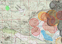
So we went. The map at right has several hand-drawn elements. The green area at left is where our home is. The purple dot near the center is where we were able to drive to (the road was closed further on). The orange circumference is my guess, based on observation from that one point, about the perimeter of the fire (as of about 7pm tonight). The red arrows are my nearly completely uniformed guess about the path of the fire, which has now broken up into numerous fires forming a ragged perimeter. The nearly circular red areas with slanting stripes are areas that showed on MODIS satellite data as having an active fire in them (as of about 11 am).

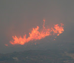
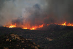
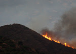
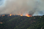
While the scene was dramatic and full of easily observed fires, it was actually quite reassuring. The fire’s center of mass was clearly at a considerable distance (at least a couple miles from where we stood), and much of the terrain between us and it had already been consumed by the fire. There were a few hot spots that were closer, in particular an entire ridge, perhaps a half mile long, that was ablaze just north of Lake Barrett. It seemed to be marching slowly and steadily toward the lake, with no action being taken to stop it. If that fire changed course and headed west, toward Lawson Peak and Gaskill Peak, that would take the fire toward us. There were also a few hotspots visible toward the junction of Lyons Valley Road and Japatul Road; if they broke loose they could also threaten us. But…these were just hotspots, and looked like (to our uneducated eyes) they could be handled by the fire crews. It certainly didn’t look like either Carveacre or Lawson Valley was in imminent danger.

The good news is the same as reported earlier, only much more so because the fire is so much larger now: an enormous swath of the fuel that was such a threat in a Santa Ana condition is now gone. Assuming we survive this one intact, our risk of a catastrophic blaze just got lowered substantially…

I saw something surprising while watching the fire, and was reminded of it as I processed my photos: there were a large number of birds in flight near the fire (I caught quite a few by accident in the photos). Many of the were either raptors, crows, or ravens. I’m guessing that they’re taking advantage of the fire, by hunting the rodents that expose themselves while fleeing the fire. That’s a twist I’d never thought of before. The mice have a choice: stand still and be roasted, or run and be eaten. Once again, for the umpteenth time, I’m very grateful that we humans don’t have to worry much about other animals trying to eat us…

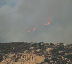
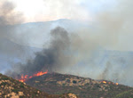
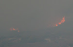
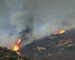
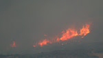
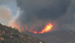
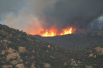
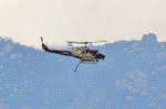
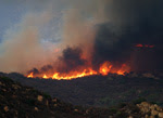
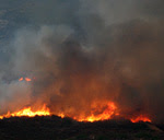
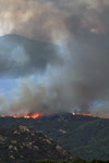
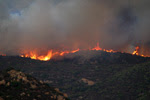
Below are a selection of the bazillion photos I took at the scene. Most of these were taken with a hand-held 620mm lens (stabilized), under very challenging low-light/high-constrast conditions. Please be forgiving of the (many) technical shortcomings — these were not taken in a studio. As usual, click on any thumbnail to get a larger (sometimes much larger!) view…

Fire

Debbie looked out our window about an hour ago and saw a thick column of smoke rising over the mountains, to our east-northeast - a certain indication of a chaparral fire. These fires are a constant worry for us, as we live in an area that hasn’t burned for many years — which means that a huge amount of fuel has built up. Each year when the chaparral gets dry (as happened within the past month), we’re surrounded on all sides by dry, easy-to-ignite, fast-burning fuel. A mental model of five-gallon gasoline cans spaced a few feet apart over the entire landscape isn’t far off the mark…

So we worry when we see smoke on the horizon. And the worry is exacerbated when (as was the case this morning) the wind is blowing that smoke right over our heads — as that means the fire is burning toward us. On the plus side, there’s almost no wind this morning — and wind is the biggest risk factor for brush fires…

On the map at right, our home is in the area marked by a green dot, and the fire took the path shown by the arrow (this is approximate, based on CDF reports). As I write this, the wind has shifted and the fire is now burning toward the northeast, up Horsethief Canyon in the general direction of Pine Valley. This is a completely unpopulated wilderness area that hasn’t burned for over 25 years; access is very limited and the terrain is extremely rugged in many areas. The CDF has numerous aircraft, engines, bulldozers, and ground crews on the fire — a fast response much appreciated by all the locals. And it looks like we can breath easier in this case…the winds are low, blowing the fire away from us, and it seems likely the fire crews will be able to get it under control soon. Helping them is the fact that I-8 is directly in the fire’s path, so they have easy access for all their equipment, should it get that far…

On the plus side, thinking very selfishly: this fire is removing some dangerous fuel that is upwind of us in a Santa Ana condition. The “Santa Anas” are winds we get a few times each year, blowing hot, dry, and hard off the desert, backwards from our normal wind pattern. They are the most dangerous time for fires, because the winds dry out the fuel and push the fires very, very quickly. Both of the big fires that have occurred near us since we moved out to Lawson Valley (the Cedar Fire and the Pines Fire) happened during a Santa Ana. So having some fuel removed in that general direction is a really good thing for us. The 90 degree swath from (about) NE to SE of us is the main danger direction for Santa Anas, and this fire will remove the fuel from about 15 degrees of that, and from only a couple miles away. A few more fires like that and our risk will go down significantly.

Update at 1 PM:

A most unlikely thing is happening: it’s raining! The forecast had a 20% chance for today, but we’ve seen those forecasts so many times — and never any rain — that we just ignore them. I wonder if the rain might have been precipitated by the smoke from the fire? In any case, we got just a small amount of rain, but enough to wet down all the brush — a major risk reduction for us. The CDF news says the fire is still growing, is well-established, and has consumed 300 acres of Horsethief Canyon. It’s still headed away from us…

Update at 3:30 PM:

The rain has stopped — but we got a quarter inch in total. That may not sound like much to those of you living in the green parts of the world, but here in the high desert it’s a veritable flood! I don’t know if it rained on the fire, though…

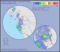
The image at right is a screen capture of the National Weather Service’s radar image, right at the peak of the rain. The smaller circle to the lower right is a magnified view of our area, centered on our house. You can see that we’re right in the most intense part of the rainfall. To the right of the yellowish high-intensity rain cell that our home is in, you can see a smaller, slightly less-intense cell — that one appears to be right smack over the fire. So maybe they did get some rain on the fire after all!

I called the CDF, and they’re now reporting that it has consumed 500 acres, and is burning in the Pine Canyon wilderness area. They’re listing several communities as “threatened", including Carveacre (which is between the fire and us) and the Barrett Lake Honor Camp (which is full of dishonorable people — go figure). As best I can tell, that means that they haven’t ruled out the possibility of the fire heading west or south, though its currently burning to the east…

The smell of smoke is strong in the air. The wind isn’t blowing the smoke onto us, though high-level air currents, far above ground level, are blowing the smoke plume high overhead. I think the rain fell right through the smoke plume, picking up the smoke particles on the way down. Now outside it is very humid, considerably cooler (in the 70s!), and very strongly smelling of damp smoke…

Saturday, July 22, 2006

Death of Liberalism

Just ran across this piece, two years old but still perfectly applicable. It’s written by Raymond S. Kraft, a fellow I don’t know, but who sounds a lot like a local personality named Roger Hedgecock. Both call themselves “recovering lawyers", and both became talk show hosts. Mr. Kraft, however, is by far the superior writer. In googling around a bit to learn about him (and to make sure this wasn’t a hoax), I discovered that he’s written many interesting essays. This one, however, is particularly good:

The Death of Liberalism

by Raymond S. Kraft

The threat is great, the battle is hard, therefore we should do nothing. We might lose!

The gangs are running wild in L.A. Somebody might get hurt. Get rid of the police!

Sixty-three years ago, Nazi Germany had overrun almost all of Europe and hammered England to the verge of bankruptcy and defeat, and had sunk more than four hundred British ships in their convoys between England and America for food and war materials.

Bushido Japan had overrun most of Asia, beginning in 1928, killing millions of civilians throughout China, and impressing millions more as slave labor.

The US was in an isolationist, pacifist, mood, and most Americans and Congress wanted nothing to do with the European war, or the Asian war.

Then along came Pearl Harbor on December 7, 1941, and in outrage Congress unanimously declared war on Japan, and the following day on Germany, which had not attacked us.

It was a dicey thing. We had few allies.

France was not an ally, the Vichy government of France aligned with its German occupiers. Germany was not an ally, it was an enemy, and Hitler intended to set up a Thousand Year Reich in Europe. Japan was not an ally, it was intent on owning and controlling all of Asia. Japan and Germany had long-term ideas of invading Canada and Mexico, and then the United States over the north and south borders, after they had settled control of Asia and Europe.

America’s allies then were England, Ireland, Scotland, Canada, Australia, and Russia, and that was about it. There were no other countries of any size or military significance with the will and ability to contribute much or anything to the effort to defeat Hitler’s Germany and Japan, and prevent the global dominance of Nazism. And we had to send millions of tons of arms, munitions, and war supplies to Russia, England, and the Canadians, Aussies, Irish, and Scots, because none of them could produce all they needed for themselves.

All of Europe, from Norway to Italy, except Russia in the east, was already under the Nazi heel.

America was not prepared for war. America had stood down most of its military after WWI and throughout the depression, at the outbreak of WWII there were army units training with broomsticks over their shoulders because they didn’t have guns, and cars with “tank” painted on the doors because they didn’t have tanks. And a big chunk of our navy had just been sunk and damaged at Pearl Harbor.

Britain had already gone bankrupt, saved only by the donation of $600 million in gold bullion in the Bank of England that was the property of Belgium and was given by Belgium to England to carry on the war when Belgium was overrun by Hitler - actually, Belgium surrendered one day, because it was unable to oppose the German invasion, and the Germans bombed Brussells into rubble the next day anyway just to prove they could.

Britain had been holding out for two years already in the face of staggering shipping loses and the near-decimation of its air force in the Battle of Britain, and was saved from being overrun by Germany only because Hitler made the mistake of thinking the Brits were a relatively minor threat that could be dealt with later and turning his attention to Russia, at a time when England was on the verge of collapse in the late summer of 1940.

Russia saved America’s ass by putting up a desperate fight for two years until the US got geared up to begin hammering away at Germany. Russia lost something like 24 million people in the seiges of Stalingrad and Moscow, 90% of them from cold and starvation, mostly civilians, but also more than a million soldiers. More than a million. Had Russia surrendered, then, Hitler would have been able to focus his entire campaign against the Brits, then America, and the Nazis would have won that war.

Had Hitler not made that mistake and invaded England in 1940 or 1941, instead, there would have been no England for the US and the Brits to use as a staging ground to prepare an assault on Nazi Europe, England would not have been able to run its North African campaign to help take a little pressure off Russia while America geared up for battle, and today Europe would very probably be run by the Nazis, the Third Reich, and, isolated and without any allies (not even the Brits), the US would very probably have had to cede Asia to the Japanese, who were basically Nazis by another name then, and the world we live in today would be very different and much worse.

I say this to illustrate that turning points in history are often dicey things. And we are at another one.

There is a very dangerous minority in Islam that either has, or wants and may soon have, the ability to deliver small nuclear, biological, or chemical weapons, almost anywhere in the world, unless they are prevented from doing so.

France, Germany, and Russia, have been selling them weapons technology at least as recently as 2002, as have North Koria, Syria, and Pakistan, paid for with billions of dollars Saddam Hussein skimmed from the “Oil For Food” program administered by the UN with the complicity of Kofi Annan and his son.

The Jihadis, the militant Muslims, are basically Nazis in Kaffiyahs - they believe that Islam, a radically conservative (definitely not liberal!) form of Wahhabi Islam, should own and control the Middle East first, then Europe, then the world, and that all who do not bow to Allah should be killed, enslaved, or subjugated. They want to finish the Holocaust, destroy Israel, purge the world of Jews. This is what they say.

There is also a civil war raging in the Middle East - for the most part not a hot war, but a war of ideas. Islam is having its Inquisition and its Reformation today, but it is not yet known which will win - the Inquisition, or the Reformation.

If the Inquisition wins, then the Wahhabis, the Jihadis, will control the Middle East, and the OPEC oil, and the US, European, and Asian economies, the techno-industrial economies, will be at the mercy of OPEC - not an OPEC dominated by the well-educated and rational Saudis of today, but an OPEC dominated by the Jihadis.

You want gas in your car? You want heating oil next winter? You want jobs? You want the dollar to be worth anything? You better hope the Jihad, the Muslim Inquisition, loses, and the Islamic Reformation wins.

If the Reformation movement wins, that is, the moderate Muslims who believe that Islam can respect and tolerate other religions, and live in peace with the rest of the world, and move out of the 10th century into the 21st, then the troubles in the Middle East will eventually fade away, and a moderate and prosperous Middle East will emerge.

We have to help the Reformation win, and to do that we have to fight the Inquisition, i.e., the Wahhabi movement, the Jihad, Al Qaeda, the Islamic terrorist movements.

We have to do it somewhere.

We cannot do it nowhere. And we cannot do it everywhere at once.

We have created a focal point for the battle now at the time and place of our choosing, in Iraq. Not in New York, not in London, or Paris, or Berlin, but in Iraq, where we did and are doing two very important things:

(1) We deposed Saddam Hussein. Whether Saddam Hussein was directly involved in 9/11 or not, it is indisputed that Saddam has been actively supporting the terrorist movement for decades. Saddam is a terrorist. Saddam is, or was, a weapon of mass destruction, who is responsible for the deaths of probably more than a million Iraqis and two million Iranians.

(2) We created a battle, a confrontation, a flash point, with Islamic terrorism in Iraq. We have focused the battle. We are killing bad guys there, and the ones we get there we won’t have to get here, or anywhere else. We also have a good shot at creating a democratic, peaceful Iraq, which will be a catalyst for democratic change in the rest of the Middle East, and an outpost for a stabilizing American military presence in the Middle East for as long as it is needed.

The Euros could have done this, but they didn’t, and they won’t. We now know that rather than opposing the rise of the Jihad, the French, Germans, and Russians were selling them arms - we have found more than a million tons of weapons and munitions in Iraq. If Iraq was not a threat to anyone, why did Saddam need a million tons of weapons?

And Iraq was paying for French, German, and Russian arms with money skimmed from the UN Oil For Food Program (supervised by UN Secretary General Kofi Annan and his son) that was supposed to pay for food, medicine, and education, for Iraqi children.

World War II, the war with the German and Japanese Nazis, really began with a “whimper” in 1928. It did not begin with Pearl Harbor. It began with the Japanese invasion of China. It was a war for fourteen years before America joined it. It officially ended in 1945 - a 17 year war - and was followed by another decade of US occupation in Germany and Japan to get those countries reconstructed and running on their own again . . . a 27 year war. World War II cost the United States an amount equal to approximately a full year’s GDP - adjusted for inflation, equal to about $12 trillion dollars, WWII cost America more than 400,000 killed in action, and nearly 100,000 still missing in action.

[The Iraq war has, so far, cost the US about $120 billion, which is roughly what 9/11 cost New York. It has also cost about 1,000 American lives, which is roughly 1/3 of the 3,000 lives that the Jihad snuffed on 9/11.]

But the cost of not fighting and winning WWII would have been unimaginably greater - a world now dominated by German and Japanese Nazism.

Americans have a short attention span, now, conditioned I suppose by 30 minute TV shows and 2-hour movies in which everything comes out okay. The real world is not like that. It is messy, uncertain, and sometimes bloody and ugly. Always has been, and probably always will be.

If we do this thing in Iraq successfully, it is probable that the Reformation will ultimately prevail. Many Muslims in the Middle East hope it will. We will be there to support it. It has begun in some countries, Libya, for instance. And Dubai. And Saudi Arabia. If we fail, the Inquisition will probably prevail, and terrorism from Islam will be with us for all the foreseeable future, because the Inquisition, or Jihad, believes they are called by Allah to kill all the Infidels, and that death in Jihad is glorious.

The bottom line here is that we will have to deal with Islamic terrorism until we defeat it, whenever that is. It will not go away on its own. It will not go away if we ignore it.

If the US can create a reasonably democratic and stable Iraq, then we have an “England” in the Middle East, a platform, from which we can work to help modernize and moderate the Middle East. The history of the world is the clash between the forces of relative civility and civilization, and the barbarians clamoring at the gates. The Iraq war is merely another battle in this ancient and never-ending war. And now, for the first time ever, the barbarians are about to get nuclear weapons. Unless we prevent them. Or somebody does.

The Iraq war is expensive, and uncertain, yes. But the consequences of not fighting it and winning it will be horrifically greater. We have four options -

1. We can defeat the Jihad now, before it gets nuclear weapons.

2. We can fight the Jihad later, after it gets nuclear weapons (which may be as early as next year, if Iran’s progress on nuclear weapons is what Iran claims it is).

3. We can surrender to the Jihad and accept its dominance in the Middle East, now, in Europe in the next few years or decades, and ultimately in America.

4. Or we can stand down now, and pick up the fight later when the Jihad is more widespread and better armed, perhaps after the Jihad has dominated France and Germany and maybe most of the rest of Europe. It will be more dangerous, more expensive, and much bloodier then.

Yes, the Jihadis say that they look forward to an Islamic America. If you oppose this war, I hope you like the idea that your children, or grandchildren, may live in an Islamic America under the Mullahs and the Sharia, an America that resembles Iran today.

We can be defeatist, as many Democrats and Liberals, peace-activists and anti-war types seem to be, and concede, surrender, to the Jihad, or we can do whatever it takes to win this war against them.

The history of the world is the history of civilizational clashes, cultural clashes. All wars are about ideas, ideas about what society and civilization should be like, and the most determined always win. Those who are willing to be the most ruthless always win. The pacifists always lose, because the anti-pacifists kill them.

In the 20th century, it was Western democracy vs. communism, and before that Western democracy vs. Nazism, and before that Western democracy vs. German Imperialism. Western democracy won, three times, but it wasn’t cheap, fun, nice, easy, or quick. Indeed, the wars against German Imperialism (WWI), Nazi Imperialism (WWII), and communist imperialism (the 40-year Cold War that included the Vietnam Battle, commonly called the Vietnam War, but itself a major battle in a larger war) covered almost the entire century.

The first major war of the 21st Century is the war between Western Judeo/Christian Civilization and Wahhabi Islam. It may last a few more years, or most of this century. It will last until the Wahhabi branch of Islam fades away, or gives up its ambitions for regional and global dominance and Jihad, or until Western Civilization gives in to the Jihad.

Senator John Kerry, in the debates and almost daily, makes 3 specious claims:

1. We went to Iraq without enough troops.

We went with the troops the US military wanted. We went with the troop levels General Tommy Franks asked for. We deposed Saddam in 30 days with light casualties, much lighter than we expected.

The real problem in Iraq is that we are trying to be nice - we are trying to fight the 1% of the population that is Jihadi, and trying to avoid killing the 99% of the population that is not a threat. We could flatten Fallujah in minutes with a flight of B52s, or seconds with one nuclear cruise missile - but we don’t. We’re trying to do brain surgery, not ampute the patient’s head. The Jihadis amputate heads.

2. We went to Iraq with too little planning.

This is a specious argument too, for it supposes that if we had just had “the right plan” the war would have been easy, cheap, quick, and clean. That is not an option. It is a guerrrilla war against a determined enemy, and no such war ever has been or ever will be easy, cheap, quick, and clean. This is not TV.

3. We proved ourselves incapable of governing and providing security.

This too is a specious argument. It was never our intention to govern and provide security. It was our intention from the beginning to do just enough to enable the Iraqis to develop a representative government and their own military and police forces to provide their own security, and that is happening. The US and the Brits and other countries there have trained over 100,000 Iraqi police and military, now, and will have trained more than 200,000 by the end of next year. We are in the process of transitioning operational control for security back to Iraq. It will take time. It will not go with no hitches. This is not TV.

Remember, perspective is everything, and America’s schools teach too little history. The Cold war lasted from about 1947 at least until the Berlin Wall came down in 1989. Forty-two years. Europe spent the first half of the 19th century fighting Napoleon, and from 1870 to 1945 fighting Germany. World War II began in 1928, lasted 17 years, plus a ten year occupation, and the US still has troops in Germany and Japan. World War II resulted in the death of more than 50 million people, maybe more than 100 million people, depending on which estimates you accept.

The US has taken a little more than 1,000 KIA in Iraq. The US took more than 4,000 KIA on the morning of June 6, 1944, the first day of the Normandy Invasion to rid Europe of Nazi Imperialism. In WWII the US averaged 2,000 KIA a week for four years. Most of the individual battles of WWII lost more Americans than the entire Iraq war has done so far.

But the stakes are at least as high . . . a world dominated by representative governments with civil rights, human rights, and personal freedoms . . . or a world dominated by a radical Islamic Wahhabi movement, by the Jihad, under the Mullahs and the Sharia.

I do not understand why the American Left does not grasp this. Too much TV I guess.

The Liberals are supposed to be in favor of human rights, civil rights, liberty, freedom, and all that. But not for Iraqis, I guess. In America, but nowhere else. 300,000 Iraqi bodies in mass graves in Iraq, not our problem. The US population is about twelve times that of Iraq, so let’s multiply 300,000 by twelve. What would you think if there were 3,600,000 American bodies in mass graves in America because of George Bush? Would you want another country to help liberate America?

"Peace Activists” always seem to demonstrate where it’s safe and ineffective to do so, in America. Why don’t we see Liberal Peace Activists demonstrating in Iran, Syria, Iraq, Sudan, North Korea, in the places in the world that really need peace activism the most?

The Liberals are supposed to be in favor of human rights, civil rights, democracy, multiculturalism, diversity, etc., but if the Jihad wins, wherever the Jihad wins, it is the end of civil rights, human rights, democracy, multiculturalsim, diversity, etc. American Liberals who oppose the liberation of Iraq are coming down on the side of their own worst enemy. If the Jihad wins, it is the death of Liberalism. Everywhere the Jihad wins, it is the death of Liberalism.

And American Liberals just don’t get it.

Raymond S. Kraft

Well said, and some points worth an all-out ponder…

Horse in the Road

Driving down one of the twisty, windy parts of Lawson Valley road, on the way home after running some errands this morning, I came around a corner to find a rearing horse in the middle of the road. By the time I stopped, it was only about 25 feet from the nose of my truck. A young girl, perhaps 13 or 14 years old, was clinging to the horse’s mane and screaming continuously — obviously terrified. The horse looked wild-eyed and frightened as well.

I’ve never been in the presence of a horse bucking and rearing like this. I was amazed how fast that horse could move up-and-down. It was a big horse, too — when it reared back, its front hooves were well over my head (and more than a little intimidating).

I put my four-way flashers on and got out of the truck, truly not at all sure what to do. I could see an older woman — presumably the girl’s mother — running up a side street, obviously upset and very overheated (it was well over 100 degrees F out). I could see that the girl had let go of the reins, so I figured grabbing them might be a good idea — but I didn’t want to make things worse by spooking the horse. So I just approached slowly and carefully — the horse didn’t even seem to see me — stayed out of range of those flailing front hooves, and I managed to catch the reins. Then when the horse came down to the pavement the next time, I pulled down hard — and that worked. In fact, it was almost like throwing a switch. The horse kind of twitched a couple times, but completely stopped trying to buck or rear up.

The girl jumped off, and ran off to her mother, who by that time had gotten close to us. I led the horse off the road, and it followed me quite docilely, as though nothing had ever happened. After tying its reins to a mailbox post, I went over to talk with the mother. She was very relieved, as you might well imagine — had some nice things to say, though I hope its true that any adult encountering such a situation would try to do the same. The girl who was riding the horse never said a word to me, or to her mother in my presence — she just clung to her mother’s leg, hard, and buried her face in her mother’s side. Poor thing — I’ll bet it’s a while before she climbs on a horse again…
Quite an adventure, compared with shopping at Home Depot! When I got home, just a few minutes later, I was still feeling the effects of the adrenaline that was pumping strong while I was near that horse — strange feeling, shaky and a bit light-headed…

Record Heat

It’s take-your-breath-away hot out here. Easily hot enough to fry an egg on your car fender. Hot in the shade. Hot even with a breeze — even with just 3% relative humidity.

It’s hot!

We had one five-minute period that was 112F — which is two degrees hotter than the previous five-minute high I’ve recorded in my weather station (which has been running for five years now).

The puppy woke us at 3:30 AM this morning, and when I took it out for a walk I was amazed at how warm it felt. I looked at the weather station, and it was 86F — really, really weird for us in the pre-dawn morning. I knew right then it would be hot today.

It’s hot!

Friday, July 21, 2006

The Window

As I followed my usual routine this morning, reading the news on my computer, I happened to glance out my office window (which faces north). I’m so glad I did…because brushstrokes of fire, set on a dark purple-blue background, framed by the silouhettes of our local mountains, covered about 90 degrees of the sky. A gorgeous new moon smiled at the fiery sunrise from a perch in the black night sky.

Beautiful. Just beautiful.

And a minute later, it was gone…

Thursday, July 20, 2006

Choices and Challenges

A week ago I posed a thought experiment to my readers, and several responded. I was looking in particular for one of Jonny Dallo’s friends to respond — they were, in the comments, excusing his actions as a “mistake” or an “accident”. Their emotion is evident — their friend is accused of an awful crime, killing a woman — and their defense of Jonny very passionate, if not particularly articulate. I wanted to see how those friends would respond to a scenario with the same basic elements, minus their friendship with the perpetrator.

BTW, if this is all new to you, search (at right) for “Jodi Burnett” and “Dallo” to get the posts and their comments for all the context…

While I had several interesting responses to my thought experiment, the responses didn’t come from one of Jonny’s friends. Until last night:

I am friends with Jonny and I guess you can call me an “apologists for Jonny Dallo.” For one thing when we say Jonny is a good kid we are not excusing him of what he did. Jonny should have consequences. That is what your friends are for I mean if I did something wrong I hope my family and friends stick it out with me. I think he should be punished but if you go in to “what if it was your mom or your friend” then are laws will never work. I mean every case is different, there are many people who do not believe in the death penalty but what is your family was the victim? I bet your view would change. I give my support to Jonny as a friend but yes what he did was wrong! If you break the law you should be punished no matter what. Joe should and so should Jonny!

"Joe” was the perpetrator in my thought experiment.

Whoever you are, my anonymous commenter, I commend you for thinking clearly about friendship and your friend’s responsibilities. And you are not a Jonny Dallo apologist. You’re articulating the exact opposite notion here…

As you read the comment above, the commenter’s internal conflict is evident: his (or her) friend did a bad thing, and the need for punishment is acknowledged — but Jonny is still his friend, and he’s going to “stick it out” with Jonny.

Imagine yourself in my commenter’s position: a friend or a loved one kills someone unintentionally, but as a result of choices and decisions they made. How do you respond to this? There are, I think, three basic possibilities:

1. You can allow your feelings for your friend or loved one romp freely over logic, and simply deny either the crime or the need for punishment. Many of Jonny’s friends — the ones I’m calling “Jonny apologists” — appear to have taken this route. This is a relatively easy course to take, it seems to me — there’s no pesky need to confront anyone, and it feels like loyalty.

2. You can say to yourself that you simply don’t want someone who does things like that to be my friend, and walk away. This is a more difficult course, cutting off emotional ties that may well be quite powerful — but its also a way to escape the discomfort of the situation. It’s harsh, but it’s easy to imagine someone feeling justified in taking the action.

3. You can do what my commenter has done: acknowledge your friend’s responsibility, acknowledge the need for punishment, and still maintain your friendship. This, I think, is the most difficult course of all — for it requires confronting your friend (and perhaps other mutual friends as well), if you’re going to be honest about your feelings and your position. A friend like this (and unlike the preceding two) could offer comfort and counsel to a perpetrator coming to terms with his choices and actions, their consequences, and his feelings about them.

Tough choices for Jonny’s friends. But Jonny’s got at least one friend taking that most difficult route…

Wednesday, July 19, 2006

Inglorious English

Most languages around the world have some elements of irregularity — words and phrases that don’t follow the rules. But linguists say that English is the most irregular of all.

The sentences below are nice examples of one particular irregularity in English: words that are spelled the same, but pronounced differently and have different meanings. They make it much easier for native English speakers to see what the fuss is about. Read them out loud for the full effect…

The bandage was wound around the wound.

The farm was used to produce produce.

The dump was so full that it had to refuse more refuse.

We must polish the Polish furniture.

He could lead if he would get the lead out.

The soldier decided to desert his dessert in the desert.

Since there is no time like the present, he thought it was time to present the present.

A bass was painted on the head of the bass drum.

When shot at, the dove dove into the bushes.

I did not object to the object.

The insurance was invalid for the invalid.

There was a row among the oarsmen about how to row.

They were too close to the door to close it.

The buck does funny things when the does are present.

A seamstress and a sewer fell down into a sewer line.

To help with planting, the farmer taught his sow to sow.

The wind was too strong to wind the sail.

Upon seeing the tear in the painting I shed a tear.

I had to subject the subject to a series of tests.

How can I intimate this to my most intimate friend?

Then there’s the English idiom. All languages have idioms, but linguists say that English idioms are the craziest of them all…

There is no egg in eggplant, nor ham in hamburger; neither apple nor pine in pineapple. English muffins weren’t invented in England or French fries in France. Sweetmeats are candies while sweetbreads, which aren’t sweet, are meat.

We take English for granted. But if we explore its paradoxes, we find that quicksand can work slowly, boxing rings are square and a guinea pig is neither from Guinea nor is it a pig.

And why is it that writers write but fingers don’t fing, grocers don’t groce and hammers don’t ham? If the plural of tooth is teeth, why isn’t the plural of booth, beeth? One goose, 2 geese. So one moose, 2 meese?

One index, 2 indices? Doesn’t it seem crazy that you can make amends but not one amend? If you have a bunch of odds and ends and get rid of all but one of them, what do you call it?

If teachers taught, why didn’t preachers praught? If a vegetarian eats vegetables, what does a humanitarian eat?

Sometimes I think all the English speakers should be committed to an asylum for the verbally insane.

In what language do people recite at a play and play at a recital? Ship by truck and send cargo by ship? Have noses that run and feet that smell? How can a slim chance and a fat chance be the same, while a wise man and a wise guy are opposites?

You have to marvel at the unique lunacy of a language in which your house can burn up as it burns down, in which you fill in a form by filling it out and in which, an alarm goes off by going on.

English was invented by people, not computers, and it reflects the creativity of the human race, which, of course, is not a race at all. That is why, when the stars are out, they are visible, but when the lights are out, they are invisible.

And why doesn’t “Buick” rhyme with “quick"?

Godless

I just finished reading “Godless: the Church of Liberalism” (by Anne Coulter), and it was both surprising and what I expected.

The expected part was Ms. Coulter’s trademark rapier wit, which will have anybody who’s not clinicly disturbed both wincing and laughing. Her barbs are mainly (but not entirely!) directed at liberals, so those who are not of the liberal persuasion will doubtless find it much more entertaining. As always, I’m in awe of Ms. Coulter’s ability to sneak a zinger into the most unlikely places. One example: in this book’s discussion of radio-carbon dating, she calls it an excellent tool for determining Helen Thomas' actual date of birth. Oooh, ouch! But I laughed out loud at that one…

The surprising part was the last few chapters of the book, which are all about Ms. Coulter’s skeptical views of Darwinist evolution. Knowing that she is a devout Christian, I expected those chapters to be ideological, faith-based rants — and therefore of little interest to me. In fact, those chapters are anything but that sort of rant. They raise interesting questions about the validity of evolution that I don’t have the expertise to answer — I’ve always just accepted evolutionary theory as the consensus view of science, and presumed that it was backed with the same rigor as (say) our understanding of chemistry or physics. Ms. Coulter makes the case that in fact evolution is not backed up by the evidence.

A point she makes repeatedly is that if it’s true (as evolutionary theory asserts) that new species evovled gradually, then the fossil record should have many examples of those intermediate forms — and those fossils have not been found. For example, if it’s true that early squirrels evolved into bats (as evolutionary biologists currently believe), then where are those half-squirrel/half-bat fossils? I can’t poke any holes in this point — every possible explanation I can think of for the absence of intermediate fossils seems unreasonable, and without any evidence I’m aware of.

Ms. Coulter also uses the squirrel/bat example to make another point: the unlikeliness of many presumed evolutionary paths. In this case, evolutionary biologists posit that the short wrist and finger bones of the early squirrels gradually elongated into the wing bones of bats. She asks a good question: how on earth could having these longer and longer bones ever have done those posited (but never seen in fossils) squirrels any good? And evolutionary theory says that they must have been beneficial mutations, else they would not have survived and prospered…and eventually become bats. Interesting question, and I know of no plausible answer.

Even with my limited knowledge of evolution, I caught Ms. Coulter on one error: she criticizes science for not having observed any speciation since they started looking about 150 years ago. The fallacy there is a question of time: 150 years is a tiny, tiny fraction of 2 billion or so years that life has been evolving on Earth (assuming evolution is correct). It shouldn’t be surprising that we haven’t witnessed speciation in such a small time period.

It’s an interesting and entertaining book, and I’ll recommend it — especially to anyone who enjoys the unrestrained display of a first-class wit…

Tuesday, July 18, 2006

Oh, No They Don't!

Tip o’the hat to JimM:

A Simple Thank You

Last week, while traveling to Chicago on business, I noticed a Marine sergeant traveling with a folded flag, but did not put two and two together. After we boarded our flight, I turned to the sergeant, who’d been invited to sit in First Class (across from me), and inquired if he was heading home.

No, he responded.

Heading out I asked?

No. I’m escorting a soldier home.

Going to pick him up?

No. He is with me right now. He was killed in Iraq. I’m taking him home to his family.

The realization of what he had been asked to do hit me like a punch to the gut. It was an honor for him. He told me that, although he didn’t know the soldier, he had delivered the news of his passing to the soldier’s family and felt as if he knew them after many conversations in so few days. I turned back to him, extended my hand, and said, Thank you. Thank you for doing what you do so my family and I can do what we do.

Upon landing in Chicago the pilot stopped short of the gate and made the following announcement over the intercom.

"Ladies and gentlemen, I would like to note that we have had the honor of having Sergeant Steeley of the United States Marine Corps join us on this flight. He is escorting a fallen comrade back home to his family. I ask that you please remain in your seats when we open the forward door to allow Sergeant Steeley to deplane and receive his fellow soldier. We will then turn off the seat belt sign."

Without a sound, all went as requested. I noticed the sergeant saluting the casket as it was brought off the plane, and his action made me realize that I am proud to be an American.

So here’s a public Thank You to our military Men and Women for what you do so we can live the way we do.

Stuart Margel — Washington, D.C.

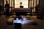
Jim also included links to the two pictures below, first and second place winners in the 63rd Pictures of the Year International competition. They are not photos of the incident described above, but obviously of a very similar one. The comments are the photographer’s (Todd Heisler of The Rocky Mountain News):

When 2nd Lt. James Cathey’s body arrived at the Reno Airport, Marines climbed into the cargo hold of the plane and draped the flag over his casket as passengers watched the family gather on the tarmac. During the arrival of another Marine’s casket last year at Denver International Airport, Major Steve Beck described the scene as one of the most powerful in the process: “See the people in the windows? They’ll sit right there in the plane, watching those Marines. You gotta wonder what’s going through their minds, knowing that they’re on the plane that brought him home,” he said. “They’re going to remember being on that plane for the rest of their lives. They’re going to remember bringing that Marine home. And they should."

The night before the burial of her husband’s body, Katherine Cathey refused to leave the casket, asking to sleep next to his body for the last time. The Marines made a bed for her, tucking in the sheets below the flag. Before she fell asleep, she opened her laptop computer and played songs that reminded her of 'Cat,' and one of the Marines asked if she wanted them to continue standing watch as she slept. “I think it would be kind of nice if you kept doing it,” she said. “I think that’s what he would have wanted."

I think she was right.