

Monday, December 16, 2013
The ghost of Christmas yet to come...
The ghost of Christmas yet to come... The ObamaCare edition. Eminent Stanford economist Michael Boskin tells us about the coming attractions of ObamaCare...
California leads the way, again!
California leads the way, again! This time, with its high failure rate to sign up the number one targeted group (uninsured Hispanics) on the California Covered ObamaCare exchange. Onward, to epic failure!
The evils of software patents...
The evils of software patents... A good summary in The Wall Street Journal. Somehow I never made the connection to Jimmy Carter before – but ... it figures...
California leads the way, again!
California leads the way, again! This time, with a creative way to increase crime rates...
That One and Mandela...
If you're vegan, then why'd you accept?
Debbie and I are on our own for Christmas this year, and we decided that we'd make some of our favorite treats just for ourselves: Debbie's broiled scallops, my Southwestern crab cakes with a sweet roasted red pepper sauce, a panettone for desert. We'll probably have some rice, and a nice savory soup. We haven't chosen the vegetables yet...
A note...
A note... My mom passed this along to me this morning, saying that she was very touched by it:
The party must end. There will be a clear, cold morning when there isn't any "more.”
No more hugs, no more special moments to celebrate together, no more phone calls just to chat, no more "Did you hear the one about..." This is true for marriages, family relationships, and, especially, old friendships.
It seems to me that one of the important things to do before that morning comes, is to let everyone of your family members and friends know that you care for them by finding simple ways to let them know your heart-felt beliefs and the guiding principles of your life, so they can always say, "She/he was my friend; and I always knew where he/she stood."
So, just in case I'm gone tomorrow, please know this: I did NOT vote for that incompetent, lying, flip-flopping, insincere, double-talking, radical-socialist, terrorist-excusing, bleeding-heart, narcissistic, scientific-and-economic moronic son-of-a bitch currently squatting in the White House!
Pater: Topo maps and compasses...

Topo maps and compasses...
My younger readers may have a bit of trouble wrapping their head around this, but ... in the not-so-distant past there were no carry-around electronic devices like a GPS that would tell you where you were. In fact, the closest equivalents to a GPS varied from microwave oven-sized devices (LORAN receivers) that could give your location to within 10 miles or so, or inertial navigation systems the size of a large room that could give your location to within a mile or so if you were lucky. When I was in the U.S. Navy, I worked on one such inertial navigation system, called SINS – exactly like the one depicted in the video below left.
Today if one goes for a hike out in the boonies, all you need is a GPS device (built into many mobile phones) and you can instantly find out where you are to within about 25' (or even more accurately if you're within WAAS range). On a device the size of a deck of playing cards, you can not only get your latitude and longitude, but also a full-color map of your location. To anyone who ever walked in the wild before the late 1980s, these devices are little short of miraculous. Prior to that, finding your way in the wild required some instruments (a good lensatic compass at a minimum, and ideally an inclinometer), topographic maps (aka “topo” maps) of the area you were in, and a slide rule or pocket trigonometric tables. It also required considerable skill, especially if you were interested in locating yourself more accurately than a few hundred yards.
Being able to navigate by compass and topo map used to be an essential skill for anyone who wanted to be in the great outdoors – hikers, skiers, hunters, fisherman, and many others considered these skills to be essential. These days, those skills are antiques, almost like knapping. The art is kept alive mainly as a hobby: orienteering. But when I was growing up, compass and topo map was state-of-the-art navigation technology – and we did a lot of hiking, so it was a skill my dad thought we should have.
When I was younger than about 11 or 12, most of the hiking I did with my dad (usually with one or more of my younger siblings with us) was done on established trails, where the ability to navigate was much less critical. Well-marked, well-traveled trails are pretty hard to get lost on, and that's what we stuck to for the most part. However, when I got a little older, we started hiking on poorly marked and less-traveled paths, and sometimes outright bushwhacking (hiking where there was no trail at all). For this sort of hiking, map-and-compass navigation was essential.
My dad was an expert at reading topo maps – what looked to me like a mass of squiggles and strange symbols was to him almost a drawing of the terrain around us. When he first started teaching me how to read a topo map, he struggled for a bit to see what was confusing me – he realized at some point that he was no longer even conscious of many of the markings. Once it dawned on him just how profoundly ignorant I was, it got a little easier :)
Early in this effort to teach me, we took a day trip out to the Appalachian Mountains in eastern Pennsylvania. The hills there are old and worn, eroded by the passage of millions of years. The gentle molding of these hills provided excellent challenges for a beginner map-and-compass navigator. On that day trip, we walked a trail-less ridge line that was perhaps two miles long. Every quarter mile or so, my dad would sit down with me, spread out our topo map of the area, and show me how one could take compass bearings on nearby distinctive features – things that one could easily find on the map and take an accurate bearing on.
I remember that I found taking a compass bearing quite challenging at first. Today, after so much practice, it seems as automatic as walking – but it certainly wasn't at first. I had trouble keeping the compass level as I took the bearing, and the lensatic compass' sighting system was hard for me to master (that system lets you simultaneously sight on some landmark and read the compass bearing; I kept sighting and then changing my position to read the compass – usually moving the compass in the process :). I also found it challenging to remember to adjust for the local magnetic declination – I understood it, but simply forgot to take it into account. My dad was very patient with me though, and eventually (after several such practice trips) I got the hang of it.
Then my dad started me on some more challenging training – navigating when you couldn't see any landmarks to take a compass bearing on. This happened mostly when you were walking through a forested valley – from that low vantage point, you often cannot see the peaks of mountains around you, just the shoulders that are closest to you. My dad taught me how to use the compass to aim yourself when walking through unbroken forest, and we spent days on the art of using identifiable things like bends in a stream, changes in slope, and rock outcroppings large enough to appear on the topo map. My dad was astoundingly good at this sort of navigation – if he had a topo map and knew his starting point, I can't imagine him ever getting lost in the mountains.
My dad had a special interest in locating specific sites with great accuracy – generally so that he could return to a particular tree, shrug, or flower patch on some later occasion. His collection of topo maps for the eastern U.S. were littered with his careful little annotations, marking these places. Usually he'd mark them with a dot and a number, then in the margins of the map you'd find a short paragraph indexed under that same number, usually with bearings to landmarks, or directions from some nearby, easily located place. In the years since then I've read (in history books) quite a few old-time surveyor's notes; my dad's notes bore a strong resemblance to them.
These highly accurate locations were considerably more challenging to do than map-and-compass navigation for hiking. When I was in my last year of high school, my dad started to teach me how to do these. It's part art (choosing landmarks, especially) and part science. There's one part where I ended up teaching my dad a little bit – he knew absolutely nothing about trigonometry. I taught him how he could calculate a position from a couple of bearings, rather than by drawing bearing lines on the map. He was fascinated to discover that this was possible, but he never did get comfortable with it, and I think never really trusted it. Drawing lines on the map he fully understood; sines and cosines seemed closely akin to magic to him. I have a memory of him, sitting in the bright sunshine on one of our training hikes, struggling to calculate a sine or cosine on my slide rule...
There's one thing about my dad's teaching me about navigation that stands out: it's the only subject I can remember him teaching me that was technical in any way. He taught me about lots of things, most especially about botany, but none of the rest of the subjects involved math, geometry, diagrams, etc. In some ways it seemed like a bit of an odd skill for him to have acquired, though certainly very useful on the many hikes he made – and, in later years, when he was acquiring specimens for an arboretum, he used it very directly to record the locations of wild specimens he found.
I know a little bit about how my dad learned map-and-compass navigation. His father (Earle Dilatush) was a sort of amateur surveyor; he even had some surveyor's instruments. My dad learned a bit about surveying from him, and those skills are very similar to those needed for map-and-compass navigation. My dad told me, once, about some training he had in the U.S. Army Air Force (this was before the Air Force was a separate branch of the military), wherein he learned how to make a primitive topographic map. This was part of the training preparing him for work as an intelligence teletype operator, though I have trouble imagining the relevance of one to the other. I also remember a book that my dad had – a large, thick book with many foldout sample maps. It had whole chapters on exactly those things my dad taught me, and there were many slips of paper with my dad's notes between its pages. I suspect he did most of his learning from that book, and lots of practice.
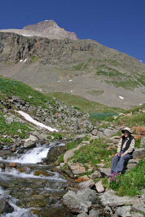
My wife and I had a magnificent vacation in the San Juan Mountains this past summer. Because that was one of the last places we had traveled with my dad, we kept seeing reminders of our time with him, nearly anywhere we went. On the trip this year, we had a modern GPS-based navigation application running on an iPad, which made our navigation ludicrously accurate and utterly convenient. On that trip with my dad (in 2005), we used topo maps, compass, and a GPS that read out latitude and longitude. I remember sitting with him on a rock next to the “road”, not far from Yankee Boy Basin (at right), our feet dangling over the edge of a steep escarpment, the two of us holding a topo map between us. For a half hour or so, we pored over that map and the surrounding rather grand scenery, happily identifying landmarks and looking for likely wildflower patches (in that area, that mainly means finding a stream, pond, or a swamp). Just like we had so many years before, we marked up the map with places to explore later (with some success, too!). It's a silly little event, but I remember it very fondly...
Subscribe to:
Posts (Atom)