Wednesday, July 26, 2006

Horse Fire XIII

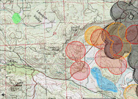
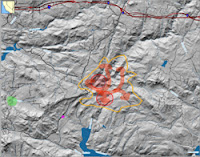
The map at right has the latest MODIS paints — none! Some of the older paints have completely fallen off ('cause they’re older than 48 hours). But on the last pass — almost directly overhead, too — the MODIS imaging didn’t find a single pixel of thermal signature for fire. The most likely reason for this is that there were no large fires left burning, just isolated smaller fires (these don’t produce enough heat to cross the MODIS threshold).

I called CDF, and their recording is now sounding positively chipper. In particular, it mentions no threat of any kind from the western flank of the fire (the one closest to us). Yahoo! They do talk about some remaining risk at Secret Canyon and Lake Morena (the orange shaded areas), but mostly they talked about containment, the need for 20 miles of perimeter construction, and the vast array of men and equipment on the scene.

We’re going to take off on a reconnoiter; if we learn anything new we’ll post within a few hours.

Horse Fire XII

Just got off the phone with a real, live — and informed — CDF person. He reports that the brunt of the fight on the Horse Fire is now on its western flank (closest to us), and that so far the firefighters there have managed to keep it all east of Lyons Valley Road, and south of Japatul Road. That’s great news for us!

Not so great news for us: the weather service is forecasting that the winds today will be toward the southwest, but light (definitely NOT a Santa Ana condition!). This would have the fire tending in our direction, with the uphill slopes it would first run into heading straight toward us.

We’re hoping those firefighters continue to prevail, and keep that horse’s ass of a fire over on the other side of the road!

The most recent MODIS data is now 12 hours old, so almost irrelevant. The next pass of a MODIS satellite is Terra, which will fly over in about 90 minutes, about 800 miles to the east. It’s just over 400 miles high, so that will give it a very oblique view (about 25 degrees). Assuming its sensors see that wide a path (I’m not sure about this), then it should have a great view of the eastern flanks of Gaskill and Lawson Peaks…

Horse Fire XI

We just got an update to the WF-HMS data. This is the data that is generated by a human analyst at NOAA, who takes into consideration all the available data (including imagery).

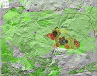
The green splotch, as usual, is where our home is located. This is zoomed in to show only the southwestern flank of the Horse Fire. The data of interest here are the small red and yellow dots — the red dots indicate fires located by the analyst within the past 24 hours, yellow dots are between 24 and 48 hours old. There are several new red dots, including one right smack in the middle of the community of Carveacre (that’s the dot by itself in the grey area, on the northwest side of the visible fire area). There are also more red dots in the area just to the north and to the east of Lake Barrett.

If this data is accurate, our hearts go out to the folks who live in Carveacre…

The areas closest to our home, with the big one kilometer diameter red MODIS splotches, doesn’t have any red dots at all — we’ll take that as good news.

And we can’t help but be amused by the red dot located right in the middle of Lake Barrett. That’s a good reminder of the “coarseness” of these data — the small red dot implies a much higher precision than is actually present. It’s entirely possible that the red dot in Carveacre is actually misplaced, much like the one in Lake Barrett. We sure hope so…

Horse Fire X

We got a bit of new satellite data last night, and with this data alone you would now think that the major part of the fire is the part nearest our home. Yikes!

On the upper map, at right, the green splotch is where our home is, and the hand-drawn orange areas are where the verbal CDF reports say the fire is. For the southwest flank (the part nearest our home) and the southeast flank (the part nearest Lake Morena), the verbal reports jibe well with the satellite data. For the northern flank, all we have are the verbal CDF reports — in a dozen or so satellite passes, we’ve never seen a single pixel of data concerning heat or flares in Secret Canyon. This makes me wonder if the verbal CDF reports are just plain wrong, and the fire is actually south of Secret Canyon, where those black MODIS paints, and the two active WF-HMS red dots are…

CDF reported late last night (after we went to bed) that the fire was now 15% contained and had burned 16,384 acres. I’m not sure how they estimate containment. My guess would be the percentage of the perimeter that they have a secure firebreak around, but that’s just a guess. The burned acreage jumps right out at a geek like me: 16,384 is an even power of two (2^14, or 128^2) — a frequently encountered number in the world of a programmer who’s familiar with machine-level operations. It seems somehow unlikely that the estimated acreage accidentally came out as such a number. More likely is the estimation algorithm is being exposed here, somehow…

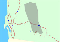
The lower map is really just for your interest. It’s the NOAA near-realtime map with every reporting option turned on (and a legend visible). The red dots are the results of human analysis; all the other dots are automated systems — algorithms running on sensor data.

Until yesterday, CDF was reporting that the cause of the Horse Fire was “under investigation”. Early lamestream media reports said it was an illegal immigrant’s campfire, but they soon backed off of that statement. Now the CDF is reporting the cause as an “escaped campfire”. So far as I know, the area where the fire started doesn’t have any campgrounds. It’s definitely an area subject to heavy illegal immigrant traffic. So I’d say the odds are that the initial report was correct — an illegal immigrant had a campfire that got out of control. But I can’t be 100% sure; I suppose it could be some loon back there camping in the National Forest, legitimately.

We’ve had a fair number of forest fires and brush fires started by illegal immigrants' campfires in recent years — I’ve even found the remains of such fires on my own property, which is kind of frightening (I’ve never seen an illegal immigrant on my property).

Have to wonder though, what anyone was doing with a campfire at 6 AM that particular Sunday. My weather system recorded the temperature at that moment as 90 F — more like air conditioner weather than campfire!

Tuesday, July 25, 2006

Horse Fire IX

Just when you think it’s safe to get a good night of unworried sleep, this darned fire jumps up and slaps you upside the head. A couple of hours ago, everything I could find out sounded like this fire was on its way down.

Now I’m not so sure.

The top map is zoomed out to show the entire fire, with satellite data that’s current as of 6 PM. The green splotch is where our home is. The purple splotch south of the west flank of the fire is a lookout point that we drove to at about 5 PM. To the north and slightly east of that vantage point, I’ve shaded in blue the places where we saw some open flames — not a huge blaze, mind you; more like a collection of bonfires a few hundred feet apart.

The MODIS data (see earlier posts for an explanation of how this data is gathered) shows active spots to the west of Lyons Valley Road for the first time. This is worrisome for us, as it indicates the fire is still burning its way toward us. As we expected, there is activity on MODIS all around the north half of Barrett Lake, and out toward Lake Morena.

The center map, directly at right, shows the same data but zoomed in to show just where our home is and that worrisome western flank of the fire. Again, the green splotch is where our home is, and the blue shaded area is where we saw flames at 5 PM. Those two red MODIS splotches closest to our home is what will keep me from sleeping well tonight…

I called the CDF info line again, and learned that they’re still estimating the burned area at 15,400 acres and just 5% contained. My own estimate, from the satellite data, is that 33 to 39 square miles (22,000 to 25,000 acres) have burned. CDF is reporting lots of assets on the fire: 1,164 people, 17 fire crews, 176 engines, 6 air tankers, 6 helicopters, 6 bulldozers, and 13 water tenders. They also say that the hot, dry weather and rugged terrain are hampering their efforts — of this I have no doubt. But it would be ever so much worse if we had bad winds, and thank goodness we do not.

The bottom map is one I have not posted about before. This is the raw WF-HMS data from NOAA. On this map, our home is the blue dot. Their mapping system is not as sophisticated as the one I’ve been showing you maps from, as you can see from cartoonish presentation. One thing that’s particularly confusing is that they use a different map projection system, which has the result that their map appears to be sort of twisted in a clockwise direction by about 20 degrees from the maps you’ve been seeing. Nevertheless, it shows more current WF-HMS data, and it has something in addition: it shows the smoke pattern observed by satellite. And in the case of the Horse Fire, you can easily see that the high-level smoke is moving off mostly to the north.

This will likely be my last post for the evening, unless something dramatic happens. The temperature is cooling off rapidly (75F right now) and the humidity is rising just as quickly (36% right now) — both very good things for the firefighters.

And we are certainly wishing those firefighters well tonight…

Horse Fire IX

The Aqua (EOS PM) satellite, one of those carrying the MODIS imaging equipment, made a pass overhead just before 3 PM. Its view of our area was fairly oblique, as it passed way to the west of us…so the western flanks of the fire may have been invisible to it, as well as anything burning deep in Secret Canyon. It does show a broad area that’s very hot, near the western side of Lake Morena — the furthest part of the Horse Fire from our home…

The darned CDF information line is a bit like playing the slots. Most of the time you just get an old recording. If you’re lucky, you get a human, but they don’t really know very much. If you hit the jackpot — and I just did — you get a human who is well-informed. And even had a sense of humor!

From my jackpot CDF lady I got a good verbal report of the areas still burning (I’ve hand-shaded these purple on the map). The one of most concern to us is the western flank of the fire, and she described an area that jibes nicely with what the survey crew told us. It’s still not an immediate concern for us. She also told us where it’s burning in Secret Canyon; that’s the northernmost purple splotch. It’s also burning on the north and east sides of Lake Barrett — but the honor camp (for dishonorable people) is still safe. And finally, the major burn area is in Bobcat Meadows, just west of the northernmost part of Lake Morena — this jibes nicely with the MODIS data.

The eastern flank of the fire — out near Lake Morena — is still in a wilderness area, but getting closer to civilized areas. I hope they can stop it before it passes Lake Morena, headed east…

Horse Fire VIII

Around 12:30 PM this afternoon we saw a quickly growing column of white smoke suddenly pop up from behind Gaskill Peak (as seen from our yard). The CDF information number was back on a recorder (with a four hour old message), and there’s been no new satellite info since 7AM. We were worried, so we decided to do another reconnoiter.

On Sunday evening, the last time we did a reconnoiter, we made it to a roadblock at the red line on the map at right. From there, we had a great view of the valley that Barrett Lake is in, and north to Horsethief and Secret Canyons, where the fire was burning. This afternoon we only made it to the purple line, where a new roadblock was installed. My theory is that the CDF is using Lyons Valley Road for helicopter operations; my evidence is that we saw four fuel trucks leaving.

Our home is in the green splotch. The blue line is roughly the ridgeline that lies between us and the fire. We’re very fond of the ridgeline — not only is it a beautiful view from our home, but it’s also a very defensible line for the fire-fighters, should the fire start burning west of Lyons Valley Road.

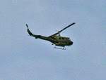
On the way down Skyline Truck Trail, and on the part of Lyons Valley Road that we could drive, we saw helicopters very low overhead, and fuel trucks parked at several locations — probably staged for quick use when needed.

Right at the roadblock, we saw a CDF survey team pickup parked, with one crewmember trying to open the locked gate. I took advantage of the moment to talk with the driver, who was very informative. From her we learned:

— The Carveacre voluntary evacuations were ordered because the community is so difficult to evacuate, with just one twisty, steep dirt road for access. It’s not that Carveacre is immediately threatened.

— The fire is still entirely east of Lyons Valley Road. She gave us a good verbal description of where it’s burning on the western flank of the fire; I’ve shaded that area in yellow on the map.

— She confirmed that the CDF was making a stand on Lyons Valley Road, and had the objective of keeping the fire on the eastern side of it.

— She told us that all the ridgetops (being defensible and accessible to the planes) were being “painted” with fire retardant.

Then her crewmate got the gate open, and they took off to do some reconnoitering of their own. As we walked back to our car, we saw the most amazingly stupid thing I’ve seen in quite a while. A pair of cars was stopped in the middle of the road, with the two drivers talking to each other through their open windows. The road was narrow in this area, so they completely blocked it. Behind them was a line of 7 firefighting vehicles, trying to get out of the Skye Valley area (near Lake Barrett), including fuel trucks, crew operations trucks, and a helicopter logistics truck. These two idiots sat there with all this equipment held up behind them, just jabbering away. When I hollered over at them that they were gumming up the works, one of the drivers answered back with a rude comment about my ancestry. But they moved, finally.

Just before we pulled out to head back home, I took a good look at the visible smoke plumes. The biggest one, by far, seemed to be coming from further east, out toward Lake Morena. The closer in burn area, on the western flank and most concerning to us, showed much less smoke. We took some comfort from that…

Horse Fire VII

Several of my readers have emailed to ask me how on earth I could possibly see anything good coming out of the Horse Fire. One of them (who shall remain unnamed) even accused me of being around-the-bend insane. This is an attempt to defend my sanity.

These maps show a larger area than the recent maps I’ve published. In both of these, there’s a purple square in the area where our home is, just to the left of center.

The upper map has pinkish areas that show all the areas burned in fires that occurred from 2000 through 2005. Those pink areas are the least likely to burn again within the next few years, because much of the fuel is gone. I’ve driven through those pink areas to the northwest of our home within the past few weeks — and even though that fire was in 2001, five years ago, there’s still very little fuel there.

But if you start with that purple square, and look at the 90 degree swath of land from about NE to about SE, you’ll see that there’s virtually nothing that’s burned within the past six years — for miles and miles and miles. During a Santa Ana wind condition, that’s the direction the winds are coming from — so any fire that started out in that direction during a Santa Ana would pose a big risk to us.

Now if you look at what the Horse Fire has done, you’ll see that it has reduced the aperture of risk considerably. Any fire starting to the east of the Horse Fire’s area will have to go around that burned area to get us. It’s still not impossible for it to do so, of course — but it’s definitely going to slow such a fire down, and remove a whole bunch of fuel that could have made it grow.

The lower map (at right) shows different green shadings for fires in the decades between 1950 and 1999. Most of that map is covered by an area burned in 1972. All of Lawson Valley, including where our house now stands, was burned that year. We’re living amidst 34 years of fuel accumulation — and that’s the same kind of accumulation that the Horse Fire is now burning in.

The most relevant thing visible on this map is due south of the Horse Fire, where there’s an area of about the same size as the fire that isn’t burned on either of these two maps. That means that there’s over 50 years of fuel accumulated in that area — making it the biggest risk area left anywhere near our home. Between that area and our home, very little has burned since 1972. If any fires pop up in that area, you can bet we’re going to be watching closely and biting our fingernails…

Horse Fire VI

Just got off the phone with a real person at CDF, instead of the recording they’ve been using. This person, who seemed to actually have some sense of what was really going on, gave me several pieces of useful information:

— Winds on the scene are light, erratic, and not a problem.

— The fire has not (yet) crossed west of Lyons Valley Road. This is the last road between the fire and Lawson Valley, where we live.

— Primary fire activity currently is near Lake Morena and on the east side of Barrett Lake.

— Wind forecast is for moderate winds to the northeast. This is good for us, bad for Guatay/Pine Valley.

Horse Fire V

Acrid smoke in the air this morning — smells very strongly, with an acidic bite. It’s reminiscent of the Cedar Fire three years ago; not a pleasant memory.

The map at right was current as of 6 AM this morning. I’ve had some questions about the satellite data and exactly what it’s showing. Here’s what I understand after some research last night and this morning.

The MODIS data shows up as one kilometer (about 0.6 miles) diameter circles with slanted line shading in them. Where there’s a circle, the satellite detected heat. The heat measurement is integrated over the entire one kilometer circular area — so a pinpoint of extremely intense heat could trigger it, and so could a broad area of much lesser heat. It does not necessarily mean fire — but it probably indicates at least some fire somewhere in that circle. The colors of the splotches indicate their age. Red splotches are less than 12 hours old; orange splotches are 12 to 24 hours old, and black splotches are more than 24 hours old.

The WF-HMS data is much different. This is data generated by the NOAA as a result of a human analyst who is looking at several different sources of data. The data available to the analyst includes MODIS, visible light imagery, smoke plume detection, and more. The analyst then makes an estimation of where actual fires are, placing dots on a 250 meter grid to indicate them. They’re visible on this map as relatively small solid red dots. The red dots are less than 24 hours old; if there were any data 24 to 48 hours old, they’d show up as yellow dots.

I’ve hand-drawn a few features on the map:

The green splotch at left is the area where our home is.

The purple arrow points to a purple dot; that’s where we stood on Sunday evening when we reconnoitered the fire. Just above and to the right of that purple dot, you can see one of the small red WF-HMS dots (just to the right of the black line that indicates Lyons Valley Road).

The blue horseshoe shaped line (open to the left) is the approximate ridge line of the line of mountains that forms Lawson Valley (where we live). The fire is on the other side of that ridge from us. This matters because ridgelines form naturally defensible lines for the firefighters — fire moves much more easily up a slope than it does down a slope, and the ridge makes and easy target for the aerial tankers. Having a very defensible line between us and the fire is a very good thing that we are taking some comfort from.

The large yellow shaded area at top and toward the left (west) is the community of Carveacre. There has been a voluntary evacuation of Carveacre for most of the past 48 hours, and we’re still trying to figure out why. The fact that the CDF has the evacuation in place is worrisome, as the community of Carveacre is (as you can see) quite close to us.

I just listened to the latest CDF report, and its a real eye-opener. First thing: they’re now reporting 15,500 acres consumed, which is very close to the estimate I made yesterday from the satellite data. There’s a lesson there: the CDF reports are not current. CDF is now reporting a lot more assets on the fire: 770 firefighters, 102 fire trucks, 8 bulldozers, 7 helicopters, and 6 aerial tanker planes. They’re still reporting just 5% containment, which probably mainly reflects the fact that the fire is mostly burning in remote wilderness areas.

The CDF also reports that with the evening, the actively burning areas are much diminished — but with the heat of the day, they expect strong flareups in three areas: Secret Canyon (the part burning to the northeast toward Pine Valley and Guatay), Hauser Canyon (the part burning to the east, and nearing the western edge of Lake Morena), and (most worrisome to us) the part burning on all sides of the northern half of Lake Barett. The latter part is four to five miles away from our home; it’s the area I took pictures of on Sunday.

As I prepared this post (and after I prepared the map at right), there was another satellite update. The MODIS data is largely unchanged.

Monday, July 24, 2006

Horse Fire IV

Verbal report from the CDF, at 12:10PM: the hotspot that is leftmost on the map in the previous post has flared up, and is burning rapidly to the northeast, up Secret Canyon toward Pine Valley and Guatay. There are voluntary evacuations of Guatay and Pine Valley underway, along with Carveacre.

There’s a lot more smoke in the air, quite suddenly.

This is not good news, but it doesn’t look like any increased threat to our home. But the fact that Carveacre keeps popping up is really bothersome — it’s the closest community to us (line of sight), and according to all the information I have, the fire is burning away from it. So why is it being evacuated?

Horse Fire III

This is the latest MODIS satellite imagery (around 11 AM). The intensities are lower, and now there are just three smallish areas with active fires. All good news.

I just called the CDF information line, and instead of a recording I got a live person. Unfortunately, this live person seemed to have no idea what he was talking about; I got no useful information from him at all, except that he said the CDF’s estimate of the size was now 7,000 acres.

So I guess its down to who am I to believe: the CDF information line, or the satellite’s lyin' eyes.

I’ll take the satellite…

Horse Fire II

Given what we saw on yesterday’s reconnoiter of the fire, we were not terribly concerned about risk to our home, but still we didn’t think it was prudent to just go to sleep — after all, this rather large wildfire was burning just over the hill from us! But around midnight, it became clear that we simply weren’t going to get any more news — every source of information shut down for the night. The MODIS satellite only makes a few passes a day over any given spot, so we’d be waiting six or eight hours between updates on it. We assessed the risk as so low that making the long road trip out to the fire wasn’t worth it (the fire was only two or three miles in a straight line from our home, but to get there on roads is about 15 miles) — so finally we just gave up, and went to bed.

As of 7 am this morning, the CDF has not posted any news for today (their message is unchanged from last night). But…the MODIS satellite data (publicly available, in near realtime) shows a huge change from last night when I finally went to sleep. The map is at right, this time shown overlayed on a US Geodetic Service topo map instead of the simple shading as I used previously. As before, the green splotch on the left is where our home is. Now, however, we’ve got all kinds of MODIS data.

The orange slant-shaded areas (two splotches) are the 24-hour old data from yesterday. The red slant-shaded areas are between 4 and 24 hours old. The red solid-shaded areas are current as of about 6:45 am this morning; they show where the fire is burning right now. The blue arrow is my hand-drawn inferred path of the main fire.

Last night the CDF message was reporting 6,000 acres burned. My very rough estimate (from the MODIS data) is that 12,000 to 15,000 acres have burned as of this morning.

For us, the most immediately concerning thing is those two solid red splotches near where the fire started. Those are in the same area that I photographed last night; likely that means there has been no firefighting activity there (and we saw none last night). If those areas started burning toward the west, we could have problems. Obviously we will be keeping an eye on that. The center-of-mass of the fire, however, is about six miles due east of the observation point where we reconnoitered last night. The fire moved a long, long way in the still evening air (my weather station recorded no wind at all last night). To some extent, I’m sure that’s due to a combination of the rugged terrain (channeling air flow) and the heavy fuel loads. The area that’s burning is very difficult to get access to — my maps don’t even show any trails, let alone roads. The easternmost front has almost reached Lake Morena (a large man-made reservoir); if it makes it past the lake, every direction is populated. And south of the entire path of the fire is also populated; the beautiful Deerhorn Valley area. If it headed north from where it is currently burning, there are several more miles of wilderness and one of the last remaining large family ranches in San Diego County, then more populated areas (and also the areas burned three years ago in the Cedar Fire).

All in all, it appears that the risk to our home is still quite low. If I lived in Deerhorn Valley or Campo, I’d be considerably less sanguine right now. And as I have said earlier, the fuel consumed by this fire is substantially lowering our risk of the particularly deadly Santa Ana-driven wildfire, because all that fuel would be upwind of us in a Santa Ana…

Update 8 AM:

The CDF is now reporting 6,600 acres burned and 5% contained. They’re also reporting exactly the expected areas as “of concern", a lesser risk than “threatened”. I can’t make sense of the 6,600 acres given the clearly larger area burned on the MODIS data — either there’s something I don’t understand about the MODIS data, or the ground reports haven’t caught up with it…

Sunday, July 23, 2006

Horse Fire

The fire that I posted about earlier today now has an official name: the “Horse Fire” (so called, I presume, because it started in the upper reaches of Horsethief Canyon). According to the last information for this evening, it has now consumed over 6,000 acres and is completely uncontained. During the day there were 4 tanker planes, 4 helicopters, 50 engines, 4 water tenders, 4 bulldozers, and 500 firemen fighting the fire. Now that its after dark, the aircraft have stood down — but the fire crews and all that equipment will be at it all night, in the relative cool and still air. We wish them all well.

This evening, just before dark, Debbie and I, along with Jim (our friend and neighbor), set off on a reconnoiter. This was prompted by the rapid growth of the smoke plume combined an ambiguous CDF message telling us that the fire was burning away from us — but that a community between us and the fire (Carveacre) was “threatened”. This made no sense to us, so we decided to see if we could eyeball it ourselves. The lack of up-to-date and accurate information in these situations is extremely frustrating. On the one hand you’re at risk of life and property from a distant foe; on the other hand you have one heck of a time finding out anything about that foe. The urge to go see it yourself is just about irresistable in those circumstances.

So we went. The map at right has several hand-drawn elements. The green area at left is where our home is. The purple dot near the center is where we were able to drive to (the road was closed further on). The orange circumference is my guess, based on observation from that one point, about the perimeter of the fire (as of about 7pm tonight). The red arrows are my nearly completely uniformed guess about the path of the fire, which has now broken up into numerous fires forming a ragged perimeter. The nearly circular red areas with slanting stripes are areas that showed on MODIS satellite data as having an active fire in them (as of about 11 am).

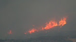
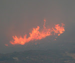
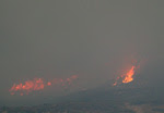
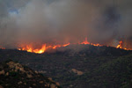
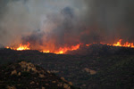
While the scene was dramatic and full of easily observed fires, it was actually quite reassuring. The fire’s center of mass was clearly at a considerable distance (at least a couple miles from where we stood), and much of the terrain between us and it had already been consumed by the fire. There were a few hot spots that were closer, in particular an entire ridge, perhaps a half mile long, that was ablaze just north of Lake Barrett. It seemed to be marching slowly and steadily toward the lake, with no action being taken to stop it. If that fire changed course and headed west, toward Lawson Peak and Gaskill Peak, that would take the fire toward us. There were also a few hotspots visible toward the junction of Lyons Valley Road and Japatul Road; if they broke loose they could also threaten us. But…these were just hotspots, and looked like (to our uneducated eyes) they could be handled by the fire crews. It certainly didn’t look like either Carveacre or Lawson Valley was in imminent danger.

The good news is the same as reported earlier, only much more so because the fire is so much larger now: an enormous swath of the fuel that was such a threat in a Santa Ana condition is now gone. Assuming we survive this one intact, our risk of a catastrophic blaze just got lowered substantially…

I saw something surprising while watching the fire, and was reminded of it as I processed my photos: there were a large number of birds in flight near the fire (I caught quite a few by accident in the photos). Many of the were either raptors, crows, or ravens. I’m guessing that they’re taking advantage of the fire, by hunting the rodents that expose themselves while fleeing the fire. That’s a twist I’d never thought of before. The mice have a choice: stand still and be roasted, or run and be eaten. Once again, for the umpteenth time, I’m very grateful that we humans don’t have to worry much about other animals trying to eat us…

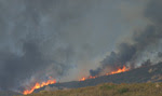
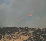
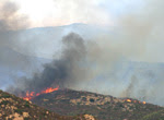
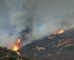
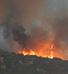
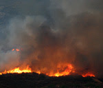
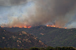
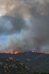
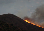
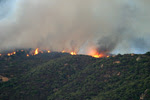
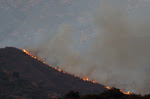
Below are a selection of the bazillion photos I took at the scene. Most of these were taken with a hand-held 620mm lens (stabilized), under very challenging low-light/high-constrast conditions. Please be forgiving of the (many) technical shortcomings — these were not taken in a studio. As usual, click on any thumbnail to get a larger (sometimes much larger!) view…

Fire

Debbie looked out our window about an hour ago and saw a thick column of smoke rising over the mountains, to our east-northeast - a certain indication of a chaparral fire. These fires are a constant worry for us, as we live in an area that hasn’t burned for many years — which means that a huge amount of fuel has built up. Each year when the chaparral gets dry (as happened within the past month), we’re surrounded on all sides by dry, easy-to-ignite, fast-burning fuel. A mental model of five-gallon gasoline cans spaced a few feet apart over the entire landscape isn’t far off the mark…

So we worry when we see smoke on the horizon. And the worry is exacerbated when (as was the case this morning) the wind is blowing that smoke right over our heads — as that means the fire is burning toward us. On the plus side, there’s almost no wind this morning — and wind is the biggest risk factor for brush fires…

On the map at right, our home is in the area marked by a green dot, and the fire took the path shown by the arrow (this is approximate, based on CDF reports). As I write this, the wind has shifted and the fire is now burning toward the northeast, up Horsethief Canyon in the general direction of Pine Valley. This is a completely unpopulated wilderness area that hasn’t burned for over 25 years; access is very limited and the terrain is extremely rugged in many areas. The CDF has numerous aircraft, engines, bulldozers, and ground crews on the fire — a fast response much appreciated by all the locals. And it looks like we can breath easier in this case…the winds are low, blowing the fire away from us, and it seems likely the fire crews will be able to get it under control soon. Helping them is the fact that I-8 is directly in the fire’s path, so they have easy access for all their equipment, should it get that far…

On the plus side, thinking very selfishly: this fire is removing some dangerous fuel that is upwind of us in a Santa Ana condition. The “Santa Anas” are winds we get a few times each year, blowing hot, dry, and hard off the desert, backwards from our normal wind pattern. They are the most dangerous time for fires, because the winds dry out the fuel and push the fires very, very quickly. Both of the big fires that have occurred near us since we moved out to Lawson Valley (the Cedar Fire and the Pines Fire) happened during a Santa Ana. So having some fuel removed in that general direction is a really good thing for us. The 90 degree swath from (about) NE to SE of us is the main danger direction for Santa Anas, and this fire will remove the fuel from about 15 degrees of that, and from only a couple miles away. A few more fires like that and our risk will go down significantly.

Update at 1 PM:

A most unlikely thing is happening: it’s raining! The forecast had a 20% chance for today, but we’ve seen those forecasts so many times — and never any rain — that we just ignore them. I wonder if the rain might have been precipitated by the smoke from the fire? In any case, we got just a small amount of rain, but enough to wet down all the brush — a major risk reduction for us. The CDF news says the fire is still growing, is well-established, and has consumed 300 acres of Horsethief Canyon. It’s still headed away from us…

Update at 3:30 PM:
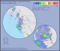
The rain has stopped — but we got a quarter inch in total. That may not sound like much to those of you living in the green parts of the world, but here in the high desert it’s a veritable flood! I don’t know if it rained on the fire, though…
The image at right is a screen capture of the National Weather Service’s radar image, right at the peak of the rain. The smaller circle to the lower right is a magnified view of our area, centered on our house. You can see that we’re right in the most intense part of the rainfall. To the right of the yellowish high-intensity rain cell that our home is in, you can see a smaller, slightly less-intense cell — that one appears to be right smack over the fire. So maybe they did get some rain on the fire after all!

I called the CDF, and they’re now reporting that it has consumed 500 acres, and is burning in the Pine Canyon wilderness area. They’re listing several communities as “threatened", including Carveacre (which is between the fire and us) and the Barrett Lake Honor Camp (which is full of dishonorable people — go figure). As best I can tell, that means that they haven’t ruled out the possibility of the fire heading west or south, though its currently burning to the east…

The smell of smoke is strong in the air. The wind isn’t blowing the smoke onto us, though high-level air currents, far above ground level, are blowing the smoke plume high overhead. I think the rain fell right through the smoke plume, picking up the smoke particles on the way down. Now outside it is very humid, considerably cooler (in the 70s!), and very strongly smelling of damp smoke…