
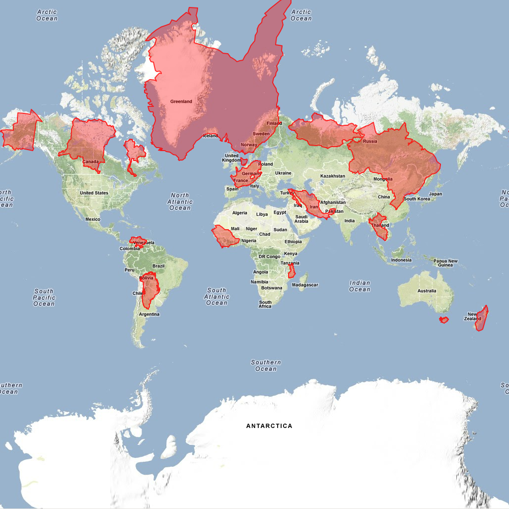
The premise of the puzzle is simple: you start with a Google Maps world projection, with 15 country outlines in red misplaced (see below). All you have to do is drag them to where they belong. If you're a bit of a geography nerd, this sounds like it should be easy – especially because most of the puzzle pieces are well-known and fairly large countries, and none of them are the little tiny countries you might expect them to throw at you. As you drag the outlines to various latitudes, you can see the shape and size change, dramatically (this is of course the result of the Mercator projection).
It took me just over 9 minutes to complete this, with one country in particular (and one that I'm very familiar with, having traveled extensively in it!) took me almost three minutes to find...
No comments:
Post a Comment